Geolocate

Morbier topographic maps

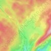
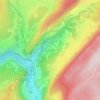
Click on a map to view its topography, its elevation and its terrain.

Col de la Savine

France > Bourgogne-Franche-Comté > Jura > Morbier

Le col de la Savine est un col de montagne routier à 984 mètres d'altitude dans le massif du Jura. Il est situé dans le département du Jura et relie Saint-Laurent-en-Grandvaux à Morez.

Average elevation: 3,261 ft

Le Glacier

France > Bourgogne-Franche-Comté > Jura > Morbier

Average elevation: 3,593 ft

Les Marais

France > Bourgogne-Franche-Comté > Jura > Morbier

Average elevation: 3,235 ft

Les Frasses

France > Bourgogne-Franche-Comté > Jura > Morbier

Average elevation: 3,169 ft

Gear up for your next adventure:

🌡️Portable Weather Meter - Track weather conditions on the trail
❄️Traction Cleats - Prevent slips on icy trails during winter hikes
📱Heavy-Duty Phone Cases - Drop-proof and waterproof protection for outdoor navigation
Backpacking Tents - Weight-optimized shelters for multi-day topographic surveys
Solar GPS Watches - Advanced multisport watches with built-in topographic maps

As an Amazon Associate, this site earns from qualifying purchases at no extra cost to you.