Geolocate

Rettenbach topographic maps

Click on a map to view its topography, its elevation and its terrain.
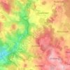
Röhrenhof

Deutschland > Bayern > Landkreis Cham > Rettenbach > Röhrenhof

Average elevation: 1,873 ft

About this place

Gear up for your next adventure:

🪶Trail Camera - Capture wildlife on your hikes
🎒Waterproof Dry Bags - Keep your electronics and maps dry inside your pack
🪶Multi‑Purpose Knife - Useful blade for camp and trail
🔦LED Headlamp - Bright and durable LED headlamp for night navigation
🌎3D Topographic Globes - Raised relief globes for a tactile understanding of geography

As an Amazon Associate, this site earns from qualifying purchases at no extra cost to you.