Geolocate

Campillo de Ranas topographic maps

Click on a map to view its topography, its elevation and its terrain.

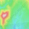
Robleluengo

España > Castilla-La Mancha > Campillo de Ranas

Average elevation: 3,937 ft

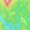
Roblelacasa

España > Castilla-La Mancha > Campillo de Ranas

Average elevation: 3,589 ft

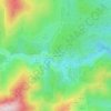
La Vereda

España > Castilla-La Mancha > Campillo de Ranas

Average elevation: 3,799 ft

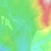
Campillejo

España > Castilla-La Mancha > Campillo de Ranas

Average elevation: 3,684 ft

El Espinar

España > Castilla-La Mancha > Campillo de Ranas

Average elevation: 3,579 ft

Matallana

España > Castilla-La Mancha > Campillo de Ranas

Average elevation: 3,553 ft

Gear up for your next adventure:

⛺Backpacking Tent - Lightweight and durable tent for multi‑day hikes
🚗GPS Dash Cams - Record your scenic drives through mountain passes and canyons
🏫Relief Map Kits - Hands-on tools for teaching landforms and elevation
⛺Backpacking Tents - Weight-optimized shelters for multi-day topographic surveys
🗻Climbing Gear Basics - Essential gear for beginner climbers

As an Amazon Associate, this site earns from qualifying purchases at no extra cost to you.