Geolocate

Paris topographic maps

Click on a map to view its topography, its elevation and its terrain.
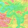
Paris

France > Paris > Paris

Paris in its early history had only the rivers Seine and Bièvre for water. From 1809, the Canal de l'Ourcq provided Paris with water from less-polluted rivers to the north-east of the capital. From 1857, the civil engineer Eugène Belgrand, under Napoleon III, oversaw the construction of a series of new…

Average elevation: 246 ft

Gear up for your next adventure:

🚁Photography Drones - Capture stunning aerial views of landforms and topography
🦺Reflective Outdoor Gear - Safety gear for low‑light conditions
🪶Survival Guide Book - Expert advice for emergency preparedness
🔥Camping Stove - Portable stove for camping and backcountry cooking
🧤Hiking Gloves - Protective gloves for rugged trails

As an Amazon Associate, this site earns from qualifying purchases at no extra cost to you.