Geolocate

Shanghai topographic maps

Click on a map to view its topography, its elevation and its terrain.
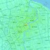
Shanghai

China > Shanghai

The golden age of Shanghai began with its elevation to municipality after it was separated from Jiangsu on 7 July 1927. This new Chinese municipality covered an area of 494.69 km2 (191.0 sq mi), including the modern-day districts of Baoshan, Yangpu, Zhabei, Nanshi, and Pudong, but excluded the foreign…

Average elevation: 16 ft

Chongming District

China > Shanghai

Average elevation: 7 ft

Gear up for your next adventure:

🔥Plasma Lighters - Windproof lighters that work in any weather condition
🥩Freeze-Dried Meals - Nutritious and lightweight food for remote expeditions
🚁Photography Drones - Capture stunning aerial views of landforms and topography
🌲Outdoor Survival Books - Best books on survival skills
🗺️Topographic Maps - Detailed topo maps for hiking, exploring and outdoor navigation

As an Amazon Associate, this site earns from qualifying purchases at no extra cost to you.