Geolocate

Paris topographic maps

Click on a map to view its topography, its elevation and its terrain.
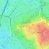
Parc des Buttes Chaumont

France > Ile-de-France > Paris

Average elevation: 240 ft

Gear up for your next adventure:

🔭Stargazing Telescopes - Perfect for camping in low-light pollution areas shown on maps
🌐World Map Poster - Decorative world maps with topographic info
📷Action Cameras - Rugged cameras to document your journeys across rugged terrain
🍳Camping Cook Set - Complete cookware for outdoor meals
🦶Carbon Trekking Poles - Reduce knee impact on steep descents with ultra-light poles

As an Amazon Associate, this site earns from qualifying purchases at no extra cost to you.