Geolocate

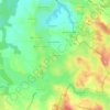
Laramière topographic maps

Click on a map to view its topography, its elevation and its terrain.

Frespech

France > Occitanie > Lot > Laramière

Average elevation: 1,207 ft

Gear up for your next adventure:

🥤Water Filter Bottle - All‑in‑one filter bottle for safe hydration
📚Navigation Handbooks - Master the art of reading topographic maps and using a compass
👟Men's Trail Runners - Lightweight footwear for fast-paced exploration and light hiking
🔭Telescopic Hiking Pole - Adjustable pole for hiking stability
🪶Paracord Bracelet - Survival bracelet with built‑in tools

As an Amazon Associate, this site earns from qualifying purchases at no extra cost to you.