Geolocate

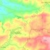
Saint-Clément-Rancoudray topographic maps

Click on a map to view its topography, its elevation and its terrain.

Moutons

France > Normandie > Manche > Saint-Clément-Rancoudray

Average elevation: 896 ft

About this place

Gear up for your next adventure:

🦶Hiking Gaiters - Keep debris and water out of your boots
🛌Ultralight Sleeping Bags - Compact down bags for cold nights in the wilderness
🧦Merino Wool Socks - Moisture-wicking, blister-preventing socks for long treks
🧭Pro Hiking Compasses - High-accuracy liquid-filled compasses for topographic orientation
⛺Backpacking Tents - Weight-optimized shelters for multi-day topographic surveys

As an Amazon Associate, this site earns from qualifying purchases at no extra cost to you.