Geolocate

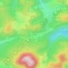
Ranrupt topographic maps

Click on a map to view its topography, its elevation and its terrain.

La Salcée

France > Grand Est > Bas-Rhin > Ranrupt

Average elevation: 2,041 ft

Gear up for your next adventure:

📖Nature Tracking Books - Learn to track wildlife and terrain
🌐World Map Poster - Decorative world maps with topographic info
📷Action Camera - Capture your outdoor adventures in HD
🏕️Tent Footprint - Protect your tent base from wear
🦶Hiking Gaiters - Keep debris and water out of your boots

As an Amazon Associate, this site earns from qualifying purchases at no extra cost to you.