Geolocate

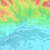
Puget topographic maps

Click on a map to view its topography, its elevation and its terrain.

Les Beaumes

France > Provence-Alpes-Côte d'Azur > Vaucluse > Puget

Average elevation: 722 ft

84360

France > Provence-Alpes-Côte d'Azur > Vaucluse > Puget

Average elevation: 951 ft

Les Borrys

France > Provence-Alpes-Côte d'Azur > Vaucluse > Puget

Average elevation: 627 ft

Gear up for your next adventure:

📖Nature Tracking Books - Learn to track wildlife and terrain
🛰️Handheld GPS Units - Professional satellite navigators for precise backcountry mapping
📡GPS Antenna Upgrade - Enhance GPS reception in remote terrain
🎒Outdoor Daypacks - Lightweight backpacks designed for carrying maps and essential gear
🔭Compact Binoculars - HD vision for scouting terrain and identifying distant landmarks

As an Amazon Associate, this site earns from qualifying purchases at no extra cost to you.