Geolocate

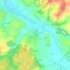
La Rochette topographic maps

Click on a map to view its topography, its elevation and its terrain.

Chez Rouget

France > Nouvelle-Aquitaine > Charente > La Rochette

Average elevation: 289 ft

Maupas

France > Nouvelle-Aquitaine > Charente > La Rochette > Maupas

Average elevation: 285 ft

La Rochette

France > Nouvelle-Aquitaine > Charente > La Rochette

Le relief est celui d'un bas plateau d'une altitude moyenne de 90 m descendant en pente douce vers la large vallée de la Tardoire qui traverse la commune du sud-est au nord-ouest. Le point culminant de la commune est à une altitude de 115 m, situé au nord sur la D.45 en limite avec Sainte-Colombe. Au…

Average elevation: 289 ft

About this place

Gear up for your next adventure:

🌄Hiking Binoculars - Compact binoculars for scenic views and trail spotting
📻Weather Alert Radios - Stay informed of storm risks while off-the-grid
🚁Photography Drones - Capture stunning aerial views of landforms and topography
🧭GPS Watch Accessories - Bands and chargers for GPS watches
🔌USB Car Charger - Car charger for on‑the‑go power needs

As an Amazon Associate, this site earns from qualifying purchases at no extra cost to you.