Geolocate

Rocroi topographic maps

Click on a map to view its topography, its elevation and its terrain.
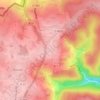
Hiraumont

France > Grand Est > Ardennes > Rocroi

Average elevation: 1,161 ft

Le Grand Hongreaux

France > Grand Est > Ardennes > Rocroi

Average elevation: 1,188 ft

Saint-Nicolas

France > Grand Est > Ardennes > Rocroi > Saint-Nicolas

Average elevation: 840 ft

Saint-Nicolas

France > Grand Est > Ardennes > Rocroi

Average elevation: 810 ft

Le Cheval Blanc

France > Grand Est > Ardennes > Rocroi

Average elevation: 1,194 ft

About this place

Gear up for your next adventure:

🚁Photography Drones - Capture stunning aerial views of landforms and topography
🪶LED Camping Lantern - Bright lantern for camp lighting
🧤Hiking Gloves - Protective gloves for rugged trails
🧥Waterproof Jacket for Hiking - Breathable and rugged rain jacket for outdoor excursions
🗺️Topographic Maps - Detailed topo maps for hiking, exploring and outdoor navigation

As an Amazon Associate, this site earns from qualifying purchases at no extra cost to you.