Geolocate

County Meath topographic maps

Click on a map to view its topography, its elevation and its terrain.

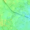
Kells

Ireland > County Meath > Kells

Average elevation: 230 ft

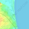
Bettystown

Ireland > County Meath

Average elevation: 20 ft

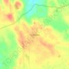
Killyon

Ireland > County Meath

Average elevation: 230 ft

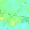
Bogganstown

Ireland > County Meath

Average elevation: 240 ft

Hill of Down

Ireland > County Meath

Average elevation: 240 ft

Castletown

Ireland > County Meath

Average elevation: 236 ft

Glenmore Forest

Ireland > County Meath

Average elevation: 151 ft

Longwood

Ireland > County Meath

Average elevation: 226 ft

Clonee

Ireland > County Meath

Average elevation: 213 ft

Ardbraccan

Ireland > County Meath

Average elevation: 217 ft

Rathfeigh

Ireland > County Meath

Average elevation: 213 ft

Mellifont

Ireland > County Meath

Average elevation: 289 ft

Ballymahon

Ireland > County Meath

Average elevation: 217 ft

Proudstown

Ireland > County Meath

Average elevation: 217 ft

Gaskinstown

Ireland > County Meath

Average elevation: 144 ft

About this place

Gear up for your next adventure:

⌚Solar GPS Watches - Advanced multisport watches with built-in topographic maps
🚑Emergency Bivvies - Heat-reflective sleeping bags for survival situations
🧭Compass with Lanyard - Easy‑carry compass for navigation
🕶️GPS Smartphone Mount - Secure mount for phone navigation
🧭GPS Watch Accessories - Bands and chargers for GPS watches

As an Amazon Associate, this site earns from qualifying purchases at no extra cost to you.