Geolocate

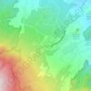
Subang topographic maps

Click on a map to view its topography, its elevation and its terrain.

Pakuhaji

Indonesia > West Java > Subang

Average elevation: 1,375 ft

Ciater

Indonesia > West Java > Subang

Average elevation: 3,632 ft

Gear up for your next adventure:

🪑Portable Camp Table - Compact table for campsite meals
🪶Camping Sleeping Pad - Comfortable sleeping pad for backpacking
🎒Hydration Pack - Hands‑free water reservoir for long hikes
🧭Pro Hiking Compasses - High-accuracy liquid-filled compasses for topographic orientation
📖Nature Tracking Books - Learn to track wildlife and terrain

As an Amazon Associate, this site earns from qualifying purchases at no extra cost to you.