
Nismes topographic map
Interactive map
Click on the map to display elevation.
About this map
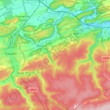
Name: Nismes topographic map, elevation, terrain.
Location: Nismes, Viroinval, Philippeville, Namur, Wallonia, Belgium (50.00888 4.52644 50.09360 4.60613)
Average elevation: 810 ft
Minimum elevation: 443 ft
Maximum elevation: 1,243 ft
Other topographic maps
Click on a map to view its topography, its elevation and its terrain.