
Stillwater topographic map
Interactive map
Click on the map to display elevation.
About this map
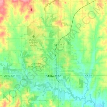
Name: Stillwater topographic map, elevation, terrain.
Location: Stillwater, Payne County, Oklahoma, United States (36.07906 -97.14957 36.20450 -97.01539)
Average elevation: 938 ft
Minimum elevation: 843 ft
Maximum elevation: 1,119 ft
Payne County trails, hiking, mountain biking, running and outdoor activities
Other topographic maps
Click on a map to view its topography, its elevation and its terrain.