Corbigny topographic map
Click on the map to display elevation.
About this map
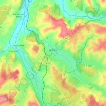
Name: Corbigny topographic map, elevation, terrain.
Average elevation: 735 ft
Minimum elevation: 587 ft
Maximum elevation: 922 ft
Other topographic maps
Click on a map to view its topography, its elevation and its terrain.


Domaine de Coddes
France > Bourgogne – Franche-Comté > Nièvre > Cercy-la-Tour
Average elevation: 719 ft




Moncey
France > Bourgogne – Franche-Comté > Nièvre > Saint-Léger-de-Fougeret
Average elevation: 1,220 ft

Le Château du Bois
France > Bourgogne – Franche-Comté > Nièvre > Entrains-sur-Nohain
Average elevation: 804 ft


Le Reux
France > Bourgogne – Franche-Comté > Nièvre > Saint-Honoré-les-Bains > Tussy
Average elevation: 1,161 ft
Les Loges de Vandenesse
France > Bourgogne – Franche-Comté > Nièvre > Saint-Honoré-les-Bains
Average elevation: 860 ft

Le Potin
France > Bourgogne – Franche-Comté > Nièvre > Châteauneuf-Val-de-Bargis
Average elevation: 984 ft