Geolocate

Paden topographic map

Click on the map to display elevation.

About this map

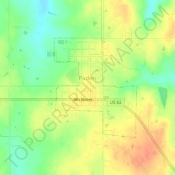
Name: Paden topographic map, elevation, terrain.

Location: Paden, Okfuskee County, Oklahoma, United States (35.49991 -96.57441 35.51524 -96.55870)

Average elevation: 978 ft

Minimum elevation: 899 ft

Maximum elevation: 1,043 ft

Okfuskee County trails, hiking, mountain biking, running and outdoor activities

Other topographic maps

Click on a map to view its topography, its elevation and its terrain.

Welty

United States > Oklahoma > Okfuskee County

Average elevation: 745 ft

Gear up for your next adventure:

🌡️Portable Weather Meter - Track weather conditions on the trail
🔋Rechargeable Batteries - Power up your outdoor devices
📱Heavy-Duty Phone Cases - Drop-proof and waterproof protection for outdoor navigation
🔥Camping Stove - Portable stove for camping and backcountry cooking
🪶Camping Sleeping Pad - Comfortable sleeping pad for backpacking

As an Amazon Associate, this site earns from qualifying purchases at no extra cost to you.