
仁寿山 topographic map
Interactive map
Click on the map to display elevation.
About this map
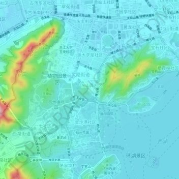
Name: 仁寿山 topographic map, elevation, terrain.
Location: 仁寿山, 灵隐街道, 西湖区, 杭州市, 浙江省, 310007, 中国 (30.23748 120.10418 30.27748 120.14418)
Average elevation: 95 ft
Minimum elevation: 10 ft
Maximum elevation: 610 ft
Other topographic maps
Click on a map to view its topography, its elevation and its terrain.