

Barron River topographic map
Click on the map to display elevation.
Barron River
The Barron's headwaters start in the Mount Hypipamee National Park near Mount Hypipamee at an elevation of 1,200 metres (3,900 ft). The river then flows north 65 kilometres (40 mi) across the Atherton Tablelands before finally turning east after Mareeba towards Kuranda. After passing under the Kuranda Range Highway's bridge and through Kuranda proper, it descends down the 260-metre (850 ft)-high Barron Falls and reaches the Cairns floodplains near Smithfield. The Dinner Falls are located along the upper Barron River.
About this map
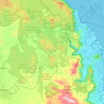
Name: Barron River topographic map, elevation, terrain.
Location: Barron River, Kuranda, Queensland, Australia (-16.94462 145.41385 -16.79775 145.75933)
Average elevation: 1,181 ft
Minimum elevation: 0 ft
Maximum elevation: 4,213 ft
Other topographic maps
Click on a map to view its topography, its elevation and its terrain.
