Geolocate

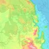
Kuranda topographic maps

Click on a map to view its topography, its elevation and its terrain.

Kowrowa

Australia > Queensland > Kuranda

Average elevation: 1,237 ft

Barron River

Australia > Queensland > Kuranda

The Barron's headwaters start in the Mount Hypipamee National Park near Mount Hypipamee at an elevation of 1,200 metres (3,900 ft). The river then flows north 65 kilometres (40 mi) across the Atherton Tablelands before finally turning east after Mareeba towards Kuranda. After passing under the Kuranda Range…

Average elevation: 1,181 ft

Gear up for your next adventure:

🔌USB Car Charger - Car charger for on‑the‑go power needs
🏔️Mountain Trail Maps - High‑detail maps for popular peaks
🌲Outdoor Survival Books - Best books on survival skills
🩹Survival Bandages - High‑quality bandages for emergencies
🧭Outdoor Navigation Book - Learn advanced navigation skills

As an Amazon Associate, this site earns from qualifying purchases at no extra cost to you.