
金平县 topographic map
Interactive map
Click on the map to display elevation.
About this map
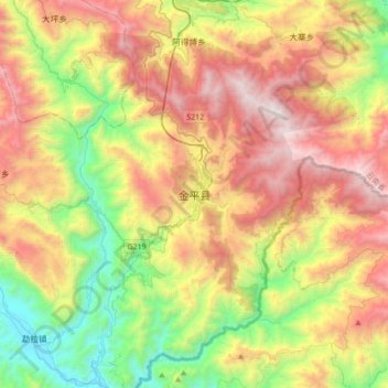
Name: 金平县 topographic map, elevation, terrain.
Location: 金平县, 金平苗族瑶族傣族自治县, 红河哈尼族彝族自治州, 云南省, 中国 (22.62259 103.06448 22.94259 103.38448)
Average elevation: 4,219 ft
Minimum elevation: 961 ft
Maximum elevation: 8,392 ft
Other topographic maps
Click on a map to view its topography, its elevation and its terrain.