
金水河镇 topographic map
Interactive map
Click on the map to display elevation.
About this map
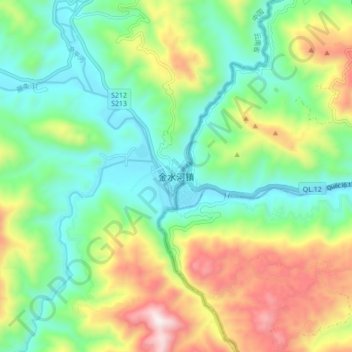
Name: 金水河镇 topographic map, elevation, terrain.
Location: 金水河镇, 金平苗族瑶族傣族自治县, 红河哈尼族彝族自治州, 云南省, 中国 (22.56519 103.12224 22.64519 103.20224)
Average elevation: 1,877 ft
Minimum elevation: 909 ft
Maximum elevation: 3,737 ft
Other topographic maps
Click on a map to view its topography, its elevation and its terrain.