Geolocate

Durack topographic map

Interactive map

Click on the map to display elevation.

About this map

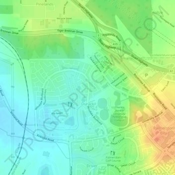
Name: Durack topographic map, elevation, terrain.

Location: Durack, City of Palmerston, Northern Territory, Australia (-12.48089 130.96186 -12.46426 130.98211)

Average elevation: 85 ft

Minimum elevation: 26 ft

Maximum elevation: 167 ft

Other topographic maps

Click on a map to view its topography, its elevation and its terrain.

Woodroffe

Australia > City of Palmerston

Woodroffe, City of Palmerston, Northern Territory, 0830, Australia

Average elevation: 79 ft

Palmerston

Australia > City of Palmerston

Palmerston, City of Palmerston, Northern Territory, 0830, Australia

Average elevation: 82 ft

Driver

Australia > City of Palmerston > Palmerston

Driver, Palmerston, City of Palmerston, Northern Territory, 0830, Australia

Average elevation: 82 ft

Bakewell

Australia > City of Palmerston > Palmerston

Bakewell, Palmerston, City of Palmerston, Northern Territory, 0830, Australia

Average elevation: 85 ft

Moulden

Australia > City of Palmerston

Moulden, City of Palmerston, Northern Territory, Australia

Average elevation: 62 ft

Gray

Australia > City of Palmerston > Palmerston

Gray, Palmerston, City of Palmerston, Northern Territory, 0830, Australia

Average elevation: 102 ft

Gunn

Australia > City of Palmerston

Gunn, City of Palmerston, Northern Territory, Australia

Average elevation: 105 ft

Zuccoli

Australia > City of Palmerston

Zuccoli, City of Palmerston, Northern Territory, Australia

Average elevation: 59 ft

Palmerston City

Australia > City of Palmerston

Palmerston City, City of Palmerston, Northern Territory, Australia

Average elevation: 108 ft