Geolocate

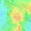
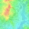
Palmerston topographic map

Click on the map to display elevation.

About this map
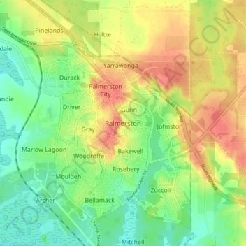
Name: Palmerston topographic map, elevation, terrain.

Location: Palmerston, City of Palmerston, Northern Territory, 0830, Australia (-12.51996 130.94441 -12.43996 131.02441)

Average elevation: 82 ft

Minimum elevation: 0 ft

Maximum elevation: 171 ft

Other topographic maps

Click on a map to view its topography, its elevation and its terrain.
Zuccoli

Australia > City of Palmerston

Average elevation: 59 ft

Palmerston City

Australia > City of Palmerston

Average elevation: 108 ft

Gunn

Australia > City of Palmerston

Average elevation: 105 ft

Gray

Australia > City of Palmerston > Palmerston

Average elevation: 102 ft

Moulden

Australia > City of Palmerston

Average elevation: 62 ft

Bakewell

Australia > City of Palmerston > Palmerston

Average elevation: 85 ft

Durack

Australia > City of Palmerston

Average elevation: 85 ft

Woodroffe

Australia > City of Palmerston

Average elevation: 79 ft

Rosebery

Australia > City of Palmerston > Palmerston

Average elevation: 62 ft

Geoid Park

Australia > City of Palmerston > Palmerston

Average elevation: 85 ft

Geoid Park

Australia > City of Palmerston > Palmerston

Average elevation: 85 ft

Gear up for your next adventure:

🪶Camp Gear Gift Set - Perfect gift bundle for outdoor fans
🚑Emergency Bivvies - Heat-reflective sleeping bags for survival situations
🥄Camping Utensil Set - Lightweight utensils for outdoor meals
🎒Waterproof Dry Bags - Keep your electronics and maps dry inside your pack
🩹Survival Bandages - High‑quality bandages for emergencies

As an Amazon Associate, this site earns from qualifying purchases at no extra cost to you.