
Domaine-Alpine topographic map
Click on the map to display elevation.
About this map
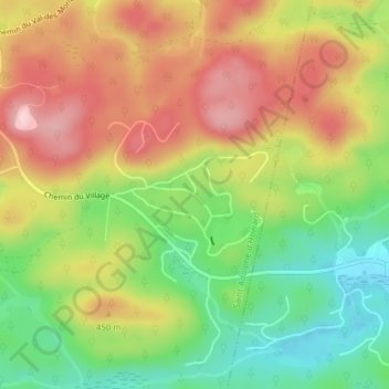
Name: Domaine-Alpine topographic map, elevation, terrain.
Average elevation: 1,283 ft
Minimum elevation: 912 ft
Maximum elevation: 1,663 ft
Other topographic maps
Click on a map to view its topography, its elevation and its terrain.
Lac Sainte-Marie
Canada > Quebec > Les Pays-d'en-Haut > Saint-Adolphe-d'Howard
Average elevation: 1,306 ft
Lac Valiquette
Canada > Quebec > Les Pays-d'en-Haut > Saint-Adolphe-d'Howard
Average elevation: 1,490 ft