Geolocate

Cressy topographic map

Click on the map to display elevation.

About this map

Name: Cressy topographic map, elevation, terrain.

Location: Cressy, Prince Edward County, Central Ontario, Ontario, Canada (44.06783 -76.90093 44.10783 -76.86093)

Average elevation: 253 ft

Minimum elevation: 230 ft

Maximum elevation: 312 ft

Other topographic maps

Click on a map to view its topography, its elevation and its terrain.
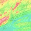
Bay of Quinte

Canada > Ontario > Prince Edward County

Average elevation: 325 ft

Bay of Quinte

Canada > Ontario > Prince Edward County

Average elevation: 325 ft

Gear up for your next adventure:

🎒Gear Packing Cubes - Organize your backpack efficiently
🪑Ultralight Camp Chairs - Portable seating for resting after a long day of mapping
🔌Solar Panel Charger - Charge gear sustainably outdoors
🛡️Insect Repellent - Protection against bugs during outdoor activities
📱Solar Portable Charger - Solar power bank for charging devices off‑grid

As an Amazon Associate, this site earns from qualifying purchases at no extra cost to you.