Geolocate

Albugnano topographic map

Click on the map to display elevation.

Albugnano

Viene definito il "balcone del Monferrato", sia per la sua altitudine, sia per il vasto panorama che offre dal suo famoso Belvedere, punto più elevato dell'intero territorio monferrino.

Wikipedia (CC-BY-SA 3.0)

About this map

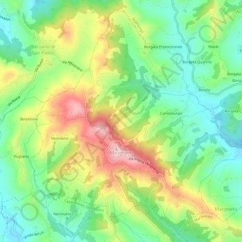
Name: Albugnano topographic map, elevation, terrain.

Location: Albugnano, Asti, Piemonte, Italia (45.06511 7.94988 45.10110 8.00595)

Average elevation: 1,220 ft

Minimum elevation: 866 ft

Maximum elevation: 1,781 ft

Other topographic maps

Click on a map to view its topography, its elevation and its terrain.

Ozzano

Italia > Piemonte > Asti > Gonengo

Average elevation: 1,125 ft

Quarto Inferiore

Italia > Piemonte > Asti > Asti

Average elevation: 472 ft

Quartino

Italia > Piemonte > Asti > Loazzolo

Average elevation: 1,047 ft

Maroero

Italia > Piemonte > Asti > Maroero

Average elevation: 1,175 ft

Fiorentina

Italia > Piemonte > Asti > Camerano Casasco

Average elevation: 738 ft

Gear up for your next adventure:

🧤Tactile Hiking Gloves - Keep hands warm while operating GPS and smartphone screens
🧭Hiking Compass - Precision compass for reliable navigation in the wilderness
🪶Survival Guide Book - Expert advice for emergency preparedness
🚗GPS Dash Cams - Record your scenic drives through mountain passes and canyons
🔭Stargazing Telescopes - Perfect for camping in low-light pollution areas shown on maps

As an Amazon Associate, this site earns from qualifying purchases at no extra cost to you.