Geolocate

Barangay 6 topographic map

Click on the map to display elevation.

About this map

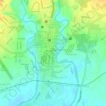
Name: Barangay 6 topographic map, elevation, terrain.

Location: Barangay 6, Lucena, Quezon, Calabarzon, 4301, Philippines (13.93260 121.61280 13.93587 121.61679)

Average elevation: 52 ft

Minimum elevation: 10 ft

Maximum elevation: 115 ft

Other topographic maps

Click on a map to view its topography, its elevation and its terrain.

Lucena

Philippines > Quezon > Lucena

Average elevation: 472 ft

Ilayang Iyam

Philippines > Quezon > Lucena > Ilayang Iyam

Average elevation: 82 ft

Gear up for your next adventure:

Solar GPS Watches - Advanced multisport watches with built-in topographic maps
☀️Outdoor Sunscreen - High protection sunscreen for outdoor activities
🌡️Handheld Weather Meters - Measure wind, temp, and pressure for safe mountain travel
💧Water Purification System - Clean water on the trail with reliable purifiers
🧦Hiking Socks - Comfortable socks to prevent blisters on long hikes

As an Amazon Associate, this site earns from qualifying purchases at no extra cost to you.