
Make a donation
Gear up for your next adventure:
As an Amazon Associate, this site earns from qualifying purchases at no extra cost to you.
Potato Lake topographic map
Click on the map to display elevation.
Make a donation
Gear up for your next adventure:
As an Amazon Associate, this site earns from qualifying purchases at no extra cost to you.
About this map
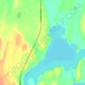
Name: Potato Lake topographic map, elevation, terrain.
Average elevation: 1,237 ft
Minimum elevation: 1,191 ft
Maximum elevation: 1,302 ft
Make a donation
Gear up for your next adventure:
As an Amazon Associate, this site earns from qualifying purchases at no extra cost to you.
Other topographic maps
Click on a map to view its topography, its elevation and its terrain.
Otter Lake
Canada > Saskatchewan > Unorganized Division No. 18 > Missinipe
Average elevation: 1,211 ft
Make a donation
Gear up for your next adventure:
As an Amazon Associate, this site earns from qualifying purchases at no extra cost to you.
Make a donation
Gear up for your next adventure:
As an Amazon Associate, this site earns from qualifying purchases at no extra cost to you.
Primrose Lake
Canada > Saskatchewan > Unorganized Division No. 18
Primrose Lake has a total surface area of 444 km2 (171 sq mi), 17.7 km2 (6.8 sq mi) of which is in Alberta, and an elevation of 559 metres (1,834 ft). It lies within muskeg and the boreal forest ecozone of Canada. There are several rivers and creeks that flow into the lake with Calder River on the northern…
Average elevation: 1,991 ft
Make a donation
Gear up for your next adventure:
As an Amazon Associate, this site earns from qualifying purchases at no extra cost to you.
Make a donation
Gear up for your next adventure:
As an Amazon Associate, this site earns from qualifying purchases at no extra cost to you.
Cree Lake
Canada > Saskatchewan > Unorganized Division No. 18
Cree Lake is the remnant of a much larger proglacial lake. The proglacial lake was formed by the meltwaters of retreating continental glaciers during the last ice age about 8,700 years ago. This proglacial lake flowed south into the Churchill River drainage basin via glacial spillways. After the retreat of the…
Average elevation: 1,667 ft