Geolocate

Winterset topographic map

Click on the map to display elevation.

About this map

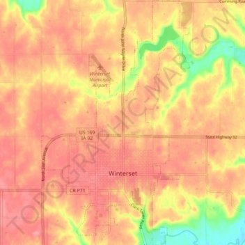
Name: Winterset topographic map, elevation, terrain.

Location: Winterset, Madison County, Iowa, United States (41.31570 -94.04231 41.38074 -93.98986)

Average elevation: 1,079 ft

Minimum elevation: 892 ft

Maximum elevation: 1,158 ft

Madison County trails, hiking, mountain biking, running and outdoor activities

Other topographic maps

Click on a map to view its topography, its elevation and its terrain.

Patterson

United States > Iowa > Madison County > Patterson > Patterson

Average elevation: 945 ft

Gear up for your next adventure:

🧣Merino Neck Gaiters - Multi-functional headwear for wind and sun protection
👓Polarized Sunglasses - Outdoor sunglasses for glare reduction
👟Men's Trail Runners - Lightweight footwear for fast-paced exploration and light hiking
📶Satellite Messenger - Communication device off‑grid
🏕️Tent Footprint - Protect your tent base from wear

As an Amazon Associate, this site earns from qualifying purchases at no extra cost to you.