Geolocate

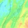
Kylemore topographic map

Click on the map to display elevation.

About this map

Name: Kylemore topographic map, elevation, terrain.

Location: Kylemore, Loughrea Municipal District, County Galway, Connacht, Ireland (53.08132 -8.38436 53.12132 -8.34436)

Average elevation: 148 ft

Minimum elevation: 105 ft

Maximum elevation: 420 ft

Other topographic maps

Click on a map to view its topography, its elevation and its terrain.
Gort

Ireland > County Galway

Average elevation: 82 ft

Athenry

Ireland > County Galway

Average elevation: 138 ft

Ballinasloe

Ireland > County Galway

Average elevation: 151 ft

Inishbofin

Ireland > County Galway

Average elevation: 23 ft

Inishmaan

Ireland > County Galway

Average elevation: 46 ft

Oughterard

Ireland > County Galway

Average elevation: 62 ft

Woodford

Ireland > County Galway

Average elevation: 279 ft

Ballyburke

Ireland > County Galway > Galway

Average elevation: 125 ft

Corcullen

Ireland > County Galway

Average elevation: 164 ft

Terryland

Ireland > County Galway > Galway

Average elevation: 39 ft

Annagh Wood

Ireland > County Galway

Average elevation: 59 ft

Rosroe

Ireland > County Galway

Average elevation: 30 ft

Ross Lake

Ireland > County Galway

Average elevation: 56 ft

Burren National Park

Ireland > County Galway

Glaciers also deposited numerous granite and limestone erratics on the pavements. The former were carried south across Galway Bay by the second-to-last glaciation. Granite boulders can be found mostly in the north of the Burren. The final ice cover came from the northeast and mostly deposited limestone…

Average elevation: 226 ft

Abbeyfield

Ireland > County Galway

Average elevation: 302 ft

Heathlawn

Ireland > County Galway

Average elevation: 180 ft

Black Weir

Ireland > County Galway

Average elevation: 20 ft

Gleninagh (Moyrus)

Ireland > County Galway

Average elevation: 801 ft

Dunmore

Ireland > County Galway

Average elevation: 207 ft

Rahoon

Ireland > County Galway > Galway

Average elevation: 138 ft

Beagh ED

Ireland > County Galway

Average elevation: 112 ft

Kilkerrin

Ireland > County Galway

Average elevation: 302 ft

Mahanagh

Ireland > County Galway

Average elevation: 112 ft

Gorterwulla

Ireland > County Galway

Average elevation: 118 ft

Milltown

Ireland > County Galway

Average elevation: 269 ft

Curraghboy

Ireland > County Galway

Average elevation: 174 ft

Ardnacross Island

Ireland > County Galway

Average elevation: 3 ft

Gear up for your next adventure:

🧦Hiking Socks - Comfortable socks to prevent blisters on long hikes
🏫Relief Map Kits - Hands-on tools for teaching landforms and elevation
👓Polarized Sunglasses - Outdoor sunglasses for glare reduction
🎒Waterproof Dry Bags - Keep your electronics and maps dry inside your pack
🚗GPS Dash Cams - Record your scenic drives through mountain passes and canyons

As an Amazon Associate, this site earns from qualifying purchases at no extra cost to you.