Geolocate

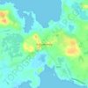
Milltown topographic map

Click on the map to display elevation.

About this map

Name: Milltown topographic map, elevation, terrain.

Location: Milltown, Shankill ED, Ballinasloe Municipal District, County Galway, Connacht, Ireland (53.52832 -8.52648 53.54212 -8.49106)

Average elevation: 269 ft

Minimum elevation: 213 ft

Maximum elevation: 364 ft

Other topographic maps

Click on a map to view its topography, its elevation and its terrain.
Galway

Ireland > County Galway > Galway

Average elevation: 85 ft

Kylemore

Ireland > County Galway

Average elevation: 148 ft

Ballyconneely

Ireland > County Galway

Average elevation: 26 ft

Inverin

Ireland > County Galway

Average elevation: 79 ft

Tynagh

Ireland > County Galway

Average elevation: 213 ft

Gear up for your next adventure:

🩳Quick‑Dry Hiking Shorts - Comfortable and quick‑dry shorts for summer hiking
🧣Hiking Neck Gaiter - Multi‑use neck protection for outdoor weather
⌚Solar GPS Watches - Advanced multisport watches with built-in topographic maps
☕Camping Coffee Makers - Enjoy premium coffee at the summit or campsite
🧭Map Reading Tools - Tools and kits for map navigation

As an Amazon Associate, this site earns from qualifying purchases at no extra cost to you.