
Castlegar topographic map
Click on the map to display elevation.
About this map
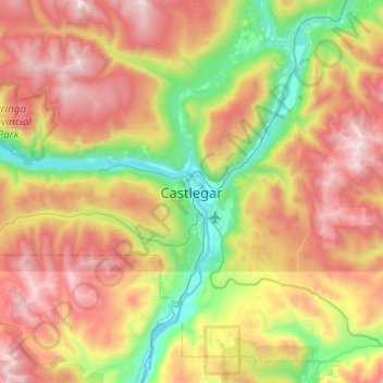
Name: Castlegar topographic map, elevation, terrain.
Average elevation: 3,960 ft
Minimum elevation: 1,335 ft
Maximum elevation: 7,536 ft
Other topographic maps
Click on a map to view its topography, its elevation and its terrain.
Columbia River
Canada > British Columbia > Regional District of Central Kootenay > Castlegar
Average elevation: 1,962 ft