
Thank you for supporting this site ❤️
Make a donation
Make a donation
Gear up for your next adventure:
As an Amazon Associate, this site earns from qualifying purchases at no extra cost to you.
Saigha topographic map
Click on the map to display elevation.
Thank you for supporting this site ❤️
Make a donation
Make a donation
Gear up for your next adventure:
As an Amazon Associate, this site earns from qualifying purchases at no extra cost to you.
About this map
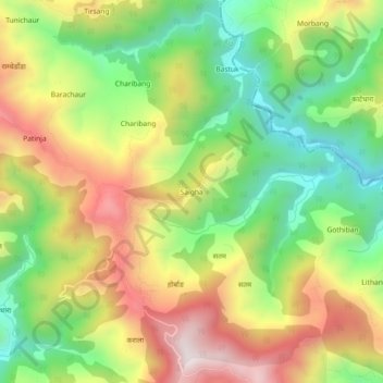
Name: Saigha topographic map, elevation, terrain.
Location: Saigha, Ghorahi-19, Ghorahi, Dang, Lumbini Province, Nepal (28.08902 82.53715 28.12902 82.57715)
Average elevation: 4,065 ft
Minimum elevation: 2,979 ft
Maximum elevation: 5,374 ft
Thank you for supporting this site ❤️
Make a donation
Make a donation
Gear up for your next adventure:
As an Amazon Associate, this site earns from qualifying purchases at no extra cost to you.