
色林错 topographic map
Interactive map
Click on the map to display elevation.
About this map
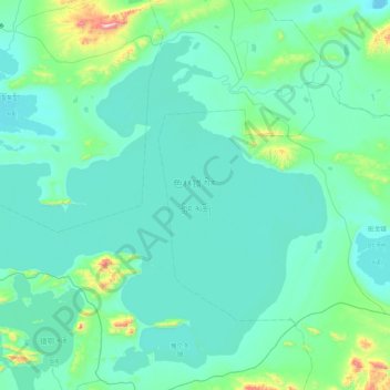
Name: 色林错 topographic map, elevation, terrain.
Location: 色林错, 申扎县, 那曲市, 西藏自治区, 中国 (31.54406 88.52142 32.13328 89.36575)
Average elevation: 15,069 ft
Minimum elevation: 14,813 ft
Maximum elevation: 17,602 ft
色林错位于西藏自治区羌塘高原南部、申扎县以北,湖面海拔4530米,湖泊东西长约72公里,平均宽约22.8公里,其中东部最宽达40公里,湖水面积2391平方公里,流域面积45530平方公里,为西藏最大的内陆湖水系。流域内有众多的河流和湖泊互相连接,组成一个封闭的内陆湖泊群,主要湖泊除色林错外,还有格仁错、吴如错、错鄂、仁错贡玛、恰规错、孜桂错等23个小湖。主要入湖河流有扎加藏布、扎根藏布、波曲藏布等。扎加藏布全长409公里,是西藏最长的内流河,发源于唐古拉山,于色林错北岸入湖。
Other topographic maps
Click on a map to view its topography, its elevation and its terrain.