
Maynooth topographic map
Click on the map to display elevation.
About this map
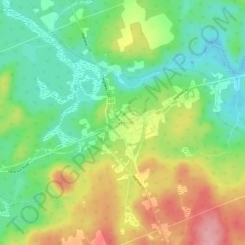
Name: Maynooth topographic map, elevation, terrain.
Average elevation: 1,398 ft
Minimum elevation: 1,220 ft
Maximum elevation: 1,650 ft
Other topographic maps
Click on a map to view its topography, its elevation and its terrain.
Little Papineau Lake
Canada > Ontario > Hastings County > Hastings Highlands
Average elevation: 1,178 ft
Baptiste Lake
Canada > Ontario > Hastings County > Hastings Highlands > Baptiste Village
Average elevation: 1,322 ft