
Papillion topographic map
Click on the map to display elevation.
About this map
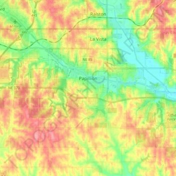
Name: Papillion topographic map, elevation, terrain.
Location: Papillion, Sarpy County, Nebraska, 68046, United States (41.11796 -96.15821 41.17635 -95.98621)
Average elevation: 1,109 ft
Minimum elevation: 974 ft
Maximum elevation: 1,250 ft
Sarpy County trails, hiking, mountain biking, running and outdoor activities
Other topographic maps
Click on a map to view its topography, its elevation and its terrain.