Geolocate

Torata topographic map

Click on the map to display elevation.

About this map

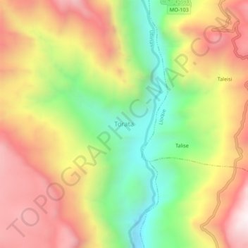
Name: Torata topographic map, elevation, terrain.

Location: Torata, General Sánchez Cerro, Moquegua, Perú (-16.37102 -70.76346 -16.33102 -70.72346)

Average elevation: 11,880 ft

Minimum elevation: 10,072 ft

Maximum elevation: 13,645 ft

Other topographic maps

Click on a map to view its topography, its elevation and its terrain.

Río Moquegua

Perú > Moquegua > Torata

Average elevation: 7,037 ft

Gear up for your next adventure:

📱Solar Portable Charger - Solar power bank for charging devices off‑grid
🧼Biodegradable Camping Soap - Eco‑friendly soap for outdoor hygiene
🪄Magnetic Compass - Accurate compass for navigation
🦶Carbon Trekking Poles - Reduce knee impact on steep descents with ultra-light poles
🥾Women's Hiking Boots - Top-rated trail boots with ankle support and superior grip

As an Amazon Associate, this site earns from qualifying purchases at no extra cost to you.