
Irvine topographic map
Interactive map
Click on the map to display elevation.
About this map
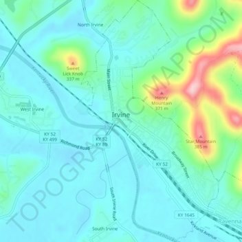
Name: Irvine topographic map, elevation, terrain.
Location: Irvine, Estill County, Kentucky, United States (37.68141 -83.98147 37.71795 -83.95506)
Average elevation: 712 ft
Minimum elevation: 577 ft
Maximum elevation: 1,230 ft
Other topographic maps
Click on a map to view its topography, its elevation and its terrain.
Sweet Lick Knob
United States > Kentucky > Estill County
Sweet Lick Knob, Estill County, Kentucky, 40336, United States
Average elevation: 686 ft
Ravenna
United States > Kentucky > Estill County
Ravenna, Estill County, Kentucky, United States
Average elevation: 715 ft
Irvine
United States > Kentucky > Estill County > Irvine > Irvine
Irvine, Estill County, Kentucky, 40336, United States
Average elevation: 794 ft