
Ravenna topographic map
Click on the map to display elevation.
About this map
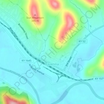
Name: Ravenna topographic map, elevation, terrain.
Location: Ravenna, Estill County, Kentucky, United States (37.68098 -83.95749 37.69433 -83.94014)
Average elevation: 715 ft
Minimum elevation: 581 ft
Maximum elevation: 1,217 ft
Estill County trails, hiking, mountain biking, running and outdoor activities
Other topographic maps
Click on a map to view its topography, its elevation and its terrain.