Geolocate

Monticello topographic map

Click on the map to display elevation.

About this map

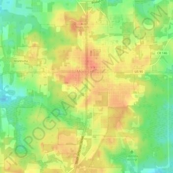
Name: Monticello topographic map, elevation, terrain.

Location: Monticello, Jefferson County, Florida, 32345, United States (30.52088 -83.89365 30.56220 -83.85142)

Average elevation: 190 ft

Minimum elevation: 95 ft

Maximum elevation: 266 ft

Jefferson County trails, hiking, mountain biking, running and outdoor activities

Other topographic maps

Click on a map to view its topography, its elevation and its terrain.

Lloyd

United States > Florida > Jefferson County

Average elevation: 108 ft

Ashville

United States > Florida > Jefferson County

Average elevation: 141 ft

Lamont

United States > Florida > Jefferson County

Average elevation: 82 ft

Wacissa

United States > Florida > Jefferson County > Wacissa

Average elevation: 82 ft

Alma

United States > Florida > Jefferson County

Average elevation: 121 ft

Gear up for your next adventure:

Backpacking Tents - Weight-optimized shelters for multi-day topographic surveys
🔭Compact Binoculars - HD vision for scouting terrain and identifying distant landmarks
🧯Emergency Survival Kit - All‑in‑one survival essentials for the backcountry
📚USA Hiking Guide Books - Top trail guides and map books
👓Polarized Sunglasses - Outdoor sunglasses for glare reduction

As an Amazon Associate, this site earns from qualifying purchases at no extra cost to you.