
Redwood topographic map
Click on the map to display elevation.
About this map
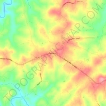
Name: Redwood topographic map, elevation, terrain.
Location: Redwood, Franklin County, Virginia, 24092, United States (36.99986 -79.83198 37.03986 -79.79198)
Average elevation: 1,063 ft
Minimum elevation: 876 ft
Maximum elevation: 1,224 ft
Franklin County trails, hiking, mountain biking, running and outdoor activities
Other topographic maps
Click on a map to view its topography, its elevation and its terrain.