Geolocate

Union Hall topographic map

Click on the map to display elevation.

About this map

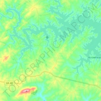
Name: Union Hall topographic map, elevation, terrain.

Location: Union Hall, Franklin County, Virginia, 24176, United States (36.98918 -79.74670 37.05117 -79.61430)

Average elevation: 889 ft

Minimum elevation: 741 ft

Maximum elevation: 1,332 ft

Franklin County trails, hiking, mountain biking, running and outdoor activities

Other topographic maps

Click on a map to view its topography, its elevation and its terrain.

Henry

United States > Virginia > Franklin County

Average elevation: 1,043 ft

Redwood

United States > Virginia > Franklin County

Average elevation: 1,063 ft

Henry Fork

United States > Virginia > Franklin County

Average elevation: 1,119 ft

Mill Creek

United States > Virginia > Franklin County

Average elevation: 1,125 ft

Lynville Mountain

United States > Virginia > Franklin County

Average elevation: 1,024 ft

Bent Mountain

United States > Virginia > Franklin County

Average elevation: 2,726 ft

Hardy Ford

United States > Virginia > Franklin County

Average elevation: 948 ft

Gear up for your next adventure:

🔋Solar Power Banks - Keep your GPS and phone charged in remote wilderness areas
🧺Microfiber Travel Towels - Compact and fast-drying towels for trail use
🧤Tactile Hiking Gloves - Keep hands warm while operating GPS and smartphone screens
💧Water Filtration Bottles - Safely drink from streams and lakes while exploring
🪓Survival Multi‑Tool - Versatile tool for camp and trail tasks

As an Amazon Associate, this site earns from qualifying purchases at no extra cost to you.