Geolocate

Bauline topographic map

Click on the map to display elevation.

About this map

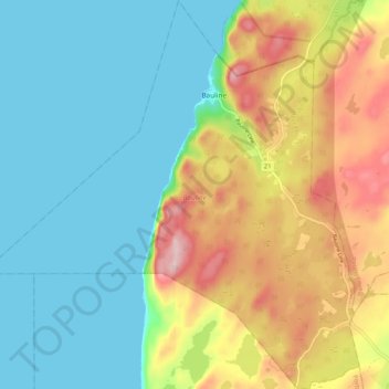
Name: Bauline topographic map, elevation, terrain.

Location: Bauline, Newfoundland, Newfoundland and Labrador, Canada (47.67018 -52.89358 47.73956 -52.79340)

Average elevation: 302 ft

Minimum elevation: 0 ft

Maximum elevation: 899 ft

Gear up for your next adventure:

🪵Folding Camp Saw - Compact saw for wood and campsite work
🪶Camp Gear Gift Set - Perfect gift bundle for outdoor fans
🔥Camping Stove - Portable stove for camping and backcountry cooking
🚗GPS Dash Cams - Record your scenic drives through mountain passes and canyons
🧭Hiking Compass - Precision compass for reliable navigation in the wilderness

As an Amazon Associate, this site earns from qualifying purchases at no extra cost to you.