
Make a donation
Gear up for your next adventure:
As an Amazon Associate, this site earns from qualifying purchases at no extra cost to you.
Ameide topographic map
Click on the map to display elevation.
Make a donation
Gear up for your next adventure:
As an Amazon Associate, this site earns from qualifying purchases at no extra cost to you.
Ameide
Naast evenementen op regelmatige basis vinden er ook andere activiteiten plaats. Ook in de directe omgeving en in de regio wordt veel georganiseerd, waarbij met name Salmsteke, op de noordoever van de Lek ter hoogte van Ameide, een belangrijk evenemententerrein is.
Make a donation
Gear up for your next adventure:
As an Amazon Associate, this site earns from qualifying purchases at no extra cost to you.
About this map
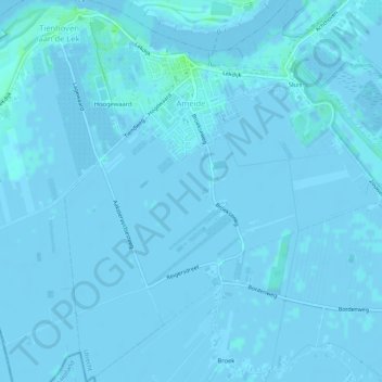
Name: Ameide topographic map, elevation, terrain.
Location: Ameide, Vijfheerenlanden, Utrecht, Nederland (51.93123 4.94551 51.96345 4.99076)
Average elevation: 0 ft
Minimum elevation: -10 ft
Maximum elevation: 23 ft
Make a donation
Gear up for your next adventure:
As an Amazon Associate, this site earns from qualifying purchases at no extra cost to you.
Other topographic maps
Click on a map to view its topography, its elevation and its terrain.
Amersfoortse Berg
Nederland > Utrecht > Amersfoort
De zuidwestelijke Amersfoortse wijk Bergkwartier is naar de heuvel vernoemd. Het parkachtige bos op de Amersfoortse Berg wordt Klein Zwitserland genoemd vanwege de voor Nederland vrij grote hoogteverschillen.
Average elevation: 62 ft
Make a donation
Gear up for your next adventure:
As an Amazon Associate, this site earns from qualifying purchases at no extra cost to you.