Geolocate

Russell topographic map

Click on the map to display elevation.

About this map

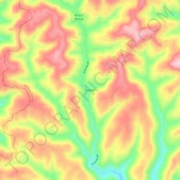
Name: Russell topographic map, elevation, terrain.

Location: Russell, Russell County, Virginia, United States (37.06261 -82.01707 37.10261 -81.97707)

Average elevation: 2,513 ft

Minimum elevation: 2,080 ft

Maximum elevation: 2,831 ft

Russell County trails, hiking, mountain biking, running and outdoor activities

Other topographic maps

Click on a map to view its topography, its elevation and its terrain.

Honaker

United States > Virginia > Russell County

Average elevation: 2,034 ft

Gear up for your next adventure:

🛰️Satellite Messengers - Emergency SOS and two-way messaging for off-grid adventures
🥩Freeze-Dried Meals - Nutritious and lightweight food for remote expeditions
🪓Survival Multi‑Tool - Versatile tool for camp and trail tasks
🔪Outdoor Multitools - Essential survival tools for gear repair and field use
🥾Women's Hiking Boots - Top-rated trail boots with ankle support and superior grip

As an Amazon Associate, this site earns from qualifying purchases at no extra cost to you.