Geolocate

Spencerville topographic map

Click on the map to display elevation.

About this map

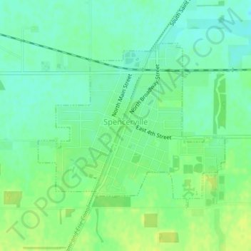
Name: Spencerville topographic map, elevation, terrain.

Location: Spencerville, Allen County, Ohio, 45887, United States (40.69966 -84.36599 40.71738 -84.33948)

Average elevation: 833 ft

Minimum elevation: 807 ft

Maximum elevation: 863 ft

Allen County trails, hiking, mountain biking, running and outdoor activities

Other topographic maps

Click on a map to view its topography, its elevation and its terrain.

Lima

United States > Ohio > Allen County

Average elevation: 876 ft

Gomer

United States > Ohio > Allen County

Average elevation: 778 ft

Westminster

United States > Ohio > Allen County

Average elevation: 965 ft

Allentown

United States > Ohio > Allen County > Lima

Average elevation: 820 ft

Conant

United States > Ohio > Allen County

Average elevation: 823 ft

Hume

United States > Ohio > Allen County

Average elevation: 853 ft

Kemp

United States > Ohio > Allen County

Average elevation: 840 ft

Landeck

United States > Ohio > Allen County

Average elevation: 794 ft

Maysville

United States > Ohio > Allen County

Average elevation: 1,007 ft

Rockport

United States > Ohio > Allen County

Average elevation: 814 ft

Scotts Crossing

United States > Ohio > Allen County

Average elevation: 784 ft

South Warsaw

United States > Ohio > Allen County

Average elevation: 928 ft

Southworth

United States > Ohio > Allen County

Average elevation: 810 ft

West Newton

United States > Ohio > Allen County

Average elevation: 1,037 ft

Gear up for your next adventure:

📶Satellite Messenger - Communication device off‑grid
📷Action Camera - Capture your outdoor adventures in HD
🧢Outdoor Hiking Hat - Sun protection hat for outdoor explorers
📱Heavy-Duty Phone Cases - Drop-proof and waterproof protection for outdoor navigation
🥾Women's Hiking Boots - Top-rated trail boots with ankle support and superior grip

As an Amazon Associate, this site earns from qualifying purchases at no extra cost to you.