Geolocate

Linden topographic map

Click on the map to display elevation.

About this map

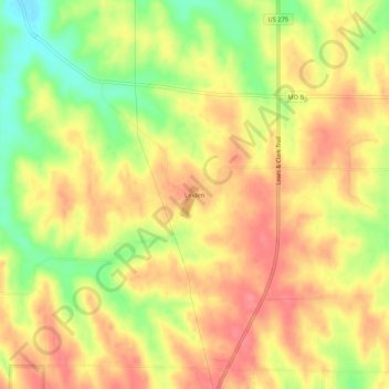
Name: Linden topographic map, elevation, terrain.

Location: Linden, Atchison County, Missouri, United States (40.46639 -95.55749 40.50639 -95.51749)

Average elevation: 1,089 ft

Minimum elevation: 932 ft

Maximum elevation: 1,191 ft

Atchison County trails, hiking, mountain biking, running and outdoor activities

Other topographic maps

Click on a map to view its topography, its elevation and its terrain.

Tarkio

United States > Missouri > Atchison County

Average elevation: 958 ft

Fairfax

United States > Missouri > Atchison County

Average elevation: 938 ft

Westboro

United States > Missouri > Atchison County

Average elevation: 1,033 ft

Watson

United States > Missouri > Atchison County

Average elevation: 902 ft

Nishnabotna

United States > Missouri > Atchison County

Average elevation: 961 ft

Gear up for your next adventure:

🎒Gear Packing Cubes - Organize your backpack efficiently
🦶Carbon Trekking Poles - Reduce knee impact on steep descents with ultra-light poles
🧦Merino Wool Socks - Moisture-wicking, blister-preventing socks for long treks
🔥Camping Stove - Portable stove for camping and backcountry cooking
👟Trail Running Shoes - Lightweight shoes for trail runners

As an Amazon Associate, this site earns from qualifying purchases at no extra cost to you.