Geolocate

Watson topographic map

Click on the map to display elevation.

About this map

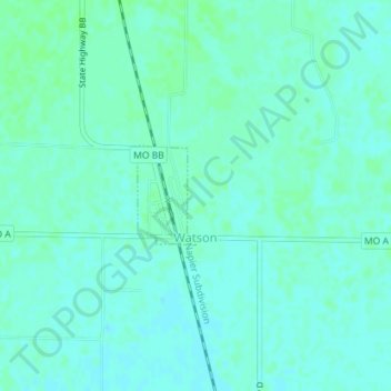
Name: Watson topographic map, elevation, terrain.

Location: Watson, Atchison County, Missouri, United States (40.47642 -95.62582 40.48331 -95.62052)

Average elevation: 902 ft

Minimum elevation: 892 ft

Maximum elevation: 912 ft

Atchison County trails, hiking, mountain biking, running and outdoor activities

Other topographic maps

Click on a map to view its topography, its elevation and its terrain.

Sonora

United States > Missouri > Atchison County

Average elevation: 906 ft

Dotham

United States > Missouri > Atchison County

Average elevation: 1,014 ft

Langdon

United States > Missouri > Atchison County

Average elevation: 889 ft

Linden

United States > Missouri > Atchison County

Average elevation: 1,089 ft

Milton

United States > Missouri > Atchison County

Average elevation: 945 ft

York

United States > Missouri > Atchison County

Average elevation: 1,053 ft

Gear up for your next adventure:

🪶Camping Sleeping Pad - Comfortable sleeping pad for backpacking
🧯Emergency Survival Kit - All‑in‑one survival essentials for the backcountry
🏫Relief Map Kits - Hands-on tools for teaching landforms and elevation
🥾Men's Hiking Boots - Durable, waterproof footwear for rugged terrain and steep inclines
📷Action Camera - Capture your outdoor adventures in HD

As an Amazon Associate, this site earns from qualifying purchases at no extra cost to you.